Creating Basemaps
Basemaps provide the geographic background used throughout GeoSight dashboards and map visualizations. They help users understand spatial context by displaying roads, terrain, satellite imagery, or other geographic reference layers beneath your indicator data.
Common basemaps include:
- OpenStreetMap
- Satellite imagery
- Terrain maps
- Light or dark cartographic styles
- Custom XYZ tile services
The Basemaps page allows users to:
| Function | Description |
|---|---|
| Create Basemaps | Add new XYZ tile or map service basemaps to GeoSight. |
| Search & Filter | Search, sort, and filter available basemaps. |
| Edit Basemaps | Update basemap settings, URLs, categories, or sharing permissions. |
| Delete Basemaps | Remove unused or outdated basemap entries. |
| Share Access | Control which users or groups can access the basemap. |
Step 1: Open the Basemaps Page
The Basemaps page is used to manage all background map layers available within GeoSight.
-
In the left-side navigation panel, click Basemaps.
-
Use the Search Basemap field to locate existing basemaps.
-
Select a basemap checkbox to enable editing or deletion tools.
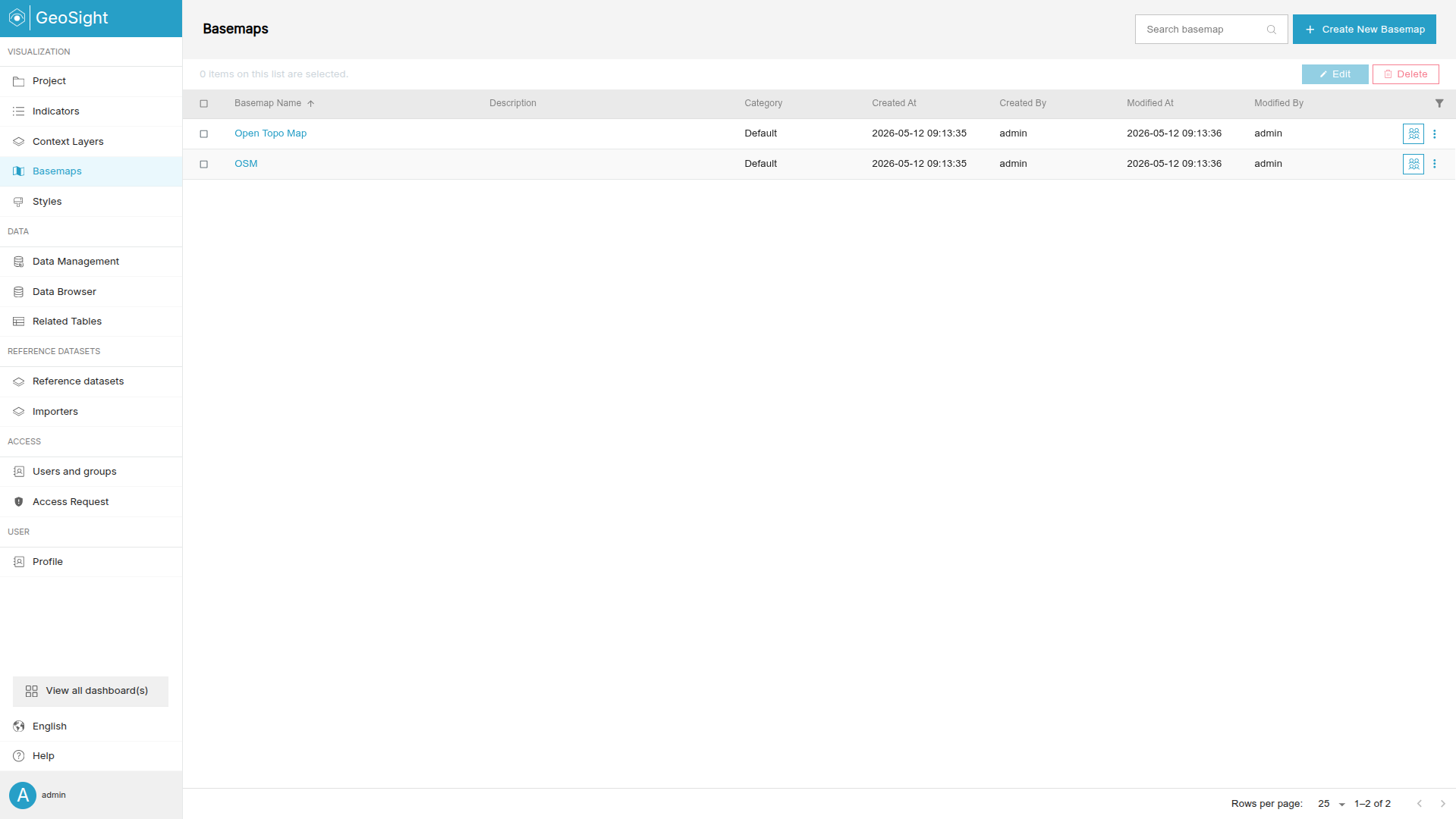
Step 2: Create a New Basemap
Creating a basemap allows you to connect GeoSight to an external tile service such as OpenStreetMap or a custom XYZ provider.
-
Click Create New Basemap.
-
Complete the required fields in the General tab.
-
Click Save.
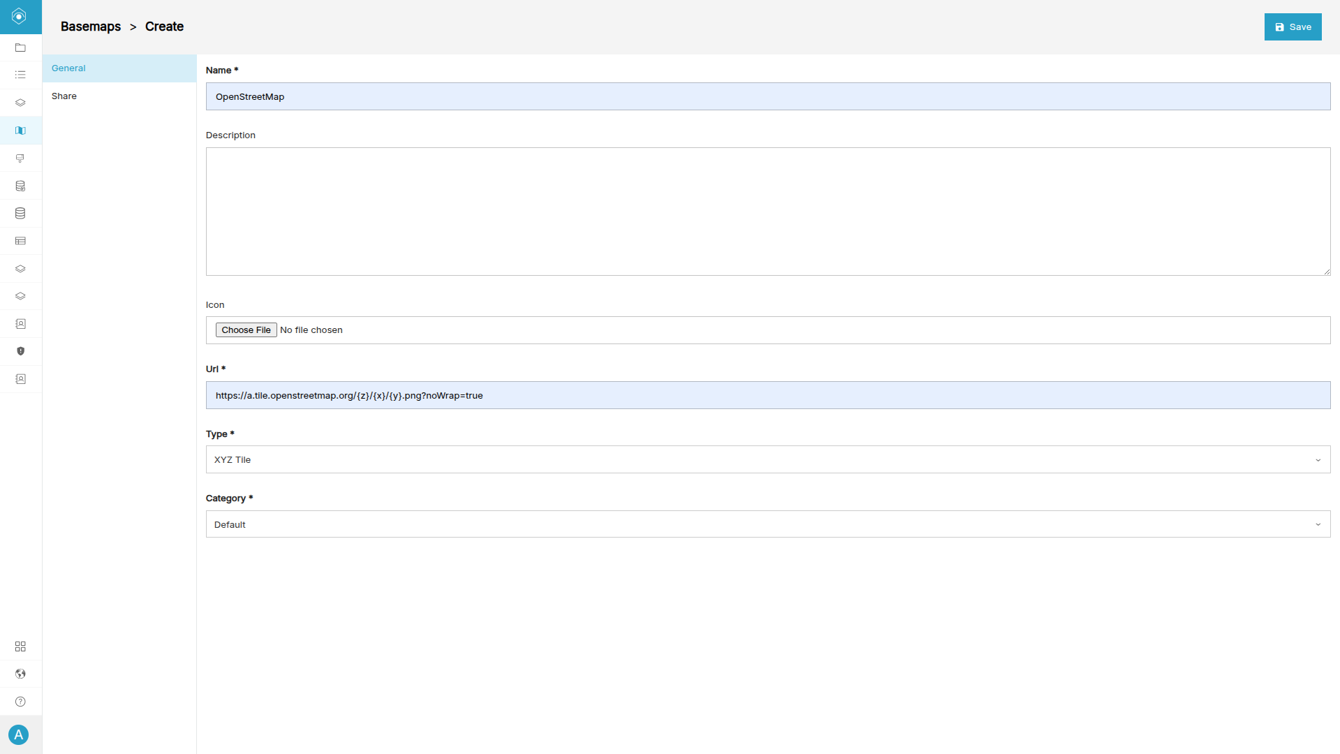
Use the following sample settings:
| Field | Example Value | Description |
|---|---|---|
| Name | OpenStreetMap | The display name of the basemap inside GeoSight. |
| URL | https://a.tile.openstreetmap.org/{z}/{x}/{y}.png?noWrap=true |
The XYZ tile service URL used to retrieve map tiles. |
| Type | XYZ Tile | The tile service type used by the basemap. |
| Category | Road Maps | A grouping category used to organize basemaps. |
{z}, {x}, and {y} to dynamically load map tiles at different zoom levels.
Step 3: Verify the Basemap
After saving the basemap, GeoSight will register the tile service and make it available within dashboards and projects.
Next up: Learn how to combine your reference datasets, indicators, indicator data, and basemaps into a complete GeoSight Project Dashboard.